Maramures represents one of Transylvania’s incontestable attractions, and below I will try to present just a few of its highlights as seen and evaluated by me.
The access roads (July 2014) are of average quality: we came from the direction of Bistrita and the road, by its segments, is roughly like this:
- Targu Mures – Bistrita: 90 km; approximately one hour and a half; a good quality road, recently modernized, busier on the Targu Mures – Reghin segment and quite deserted from Reghin to Bistrita, where you can choose the bypass route if you do not wish to visit the city of Bistrita.
- Bistrita – Borsa: 95 km; approximately two hours; a road of relatively poor quality, patched, but which does not create major problems except in the town of Moisei and Borsa itself (where work is being done in places or where works have been abandoned); from what I saw while traveling toward Viseu de Sus, the road from Moisei to Sighetu Marmatiei is modernized and in very good condition.
On this route, we stopped twice to eat, and I recommend the options we chose to you as well: at the exit from Bistrita, the Morariu Guesthouse Restaurant (their website: here), and in the area of Fiad village, at Popasul Haiducilor (their website: here).
One of the main dilemmas you face when exploring an area is choosing the place where you set up your “headquarters”—namely, whether you opt for a single accommodation location or two; we opted for the town of Borsa at the Valcinet Guesthouse (their website isn’t great, but information can be found here), an inspired choice (my impressions regarding the location: here).
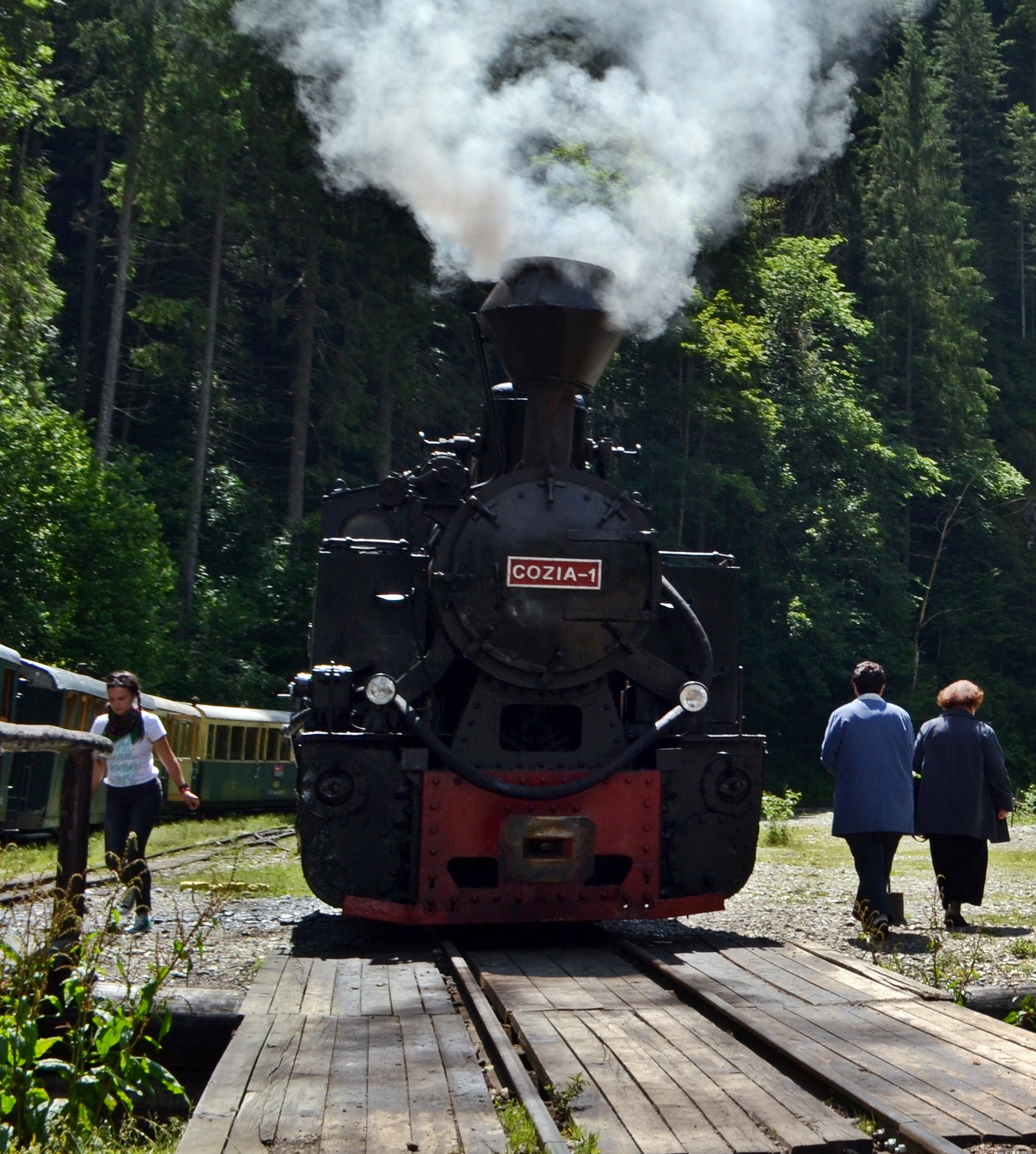
A ride on the Mocănița through the Vaser Valley seems like a natural choice when you arrive in these parts, and yet there are a few details you should keep in mind:
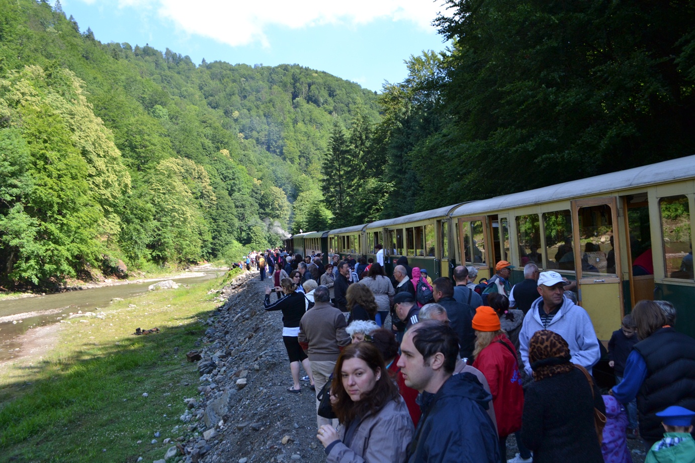
- during the summer, the crowds can be quite large, and I believe the weekends are extremely busy (I understand that even 2–3 trains depart when there is a high influx of tourists); if you don’t have a reservation made by phone, it’s best to arrive there at least half an hour before the train leaves the station (08:30)
- mornings in the area can be quite chilly, so you’d do well to take a thicker coat, and if there’s a risk of rain, take something waterproof too (when I was there, out of the train’s 7 small carriages, 3 were without windows—so they offer no protection against rain and cold)
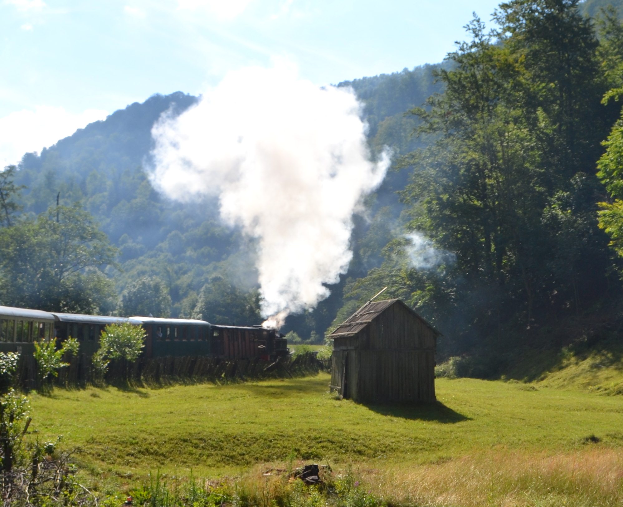
The route itself is picturesque, even if the first third of it is through a valley with homesteads and logging operations; the route is about 22 kilometers long, and on the way up, there are three stops to refuel with water and coal, whereas on the way down, there is only one stop.
Being a tourist train, the waiting times, the departure and return schedules, the stops… they are all quite approximate, so do not count on returning to the Viseu station at an exact time.
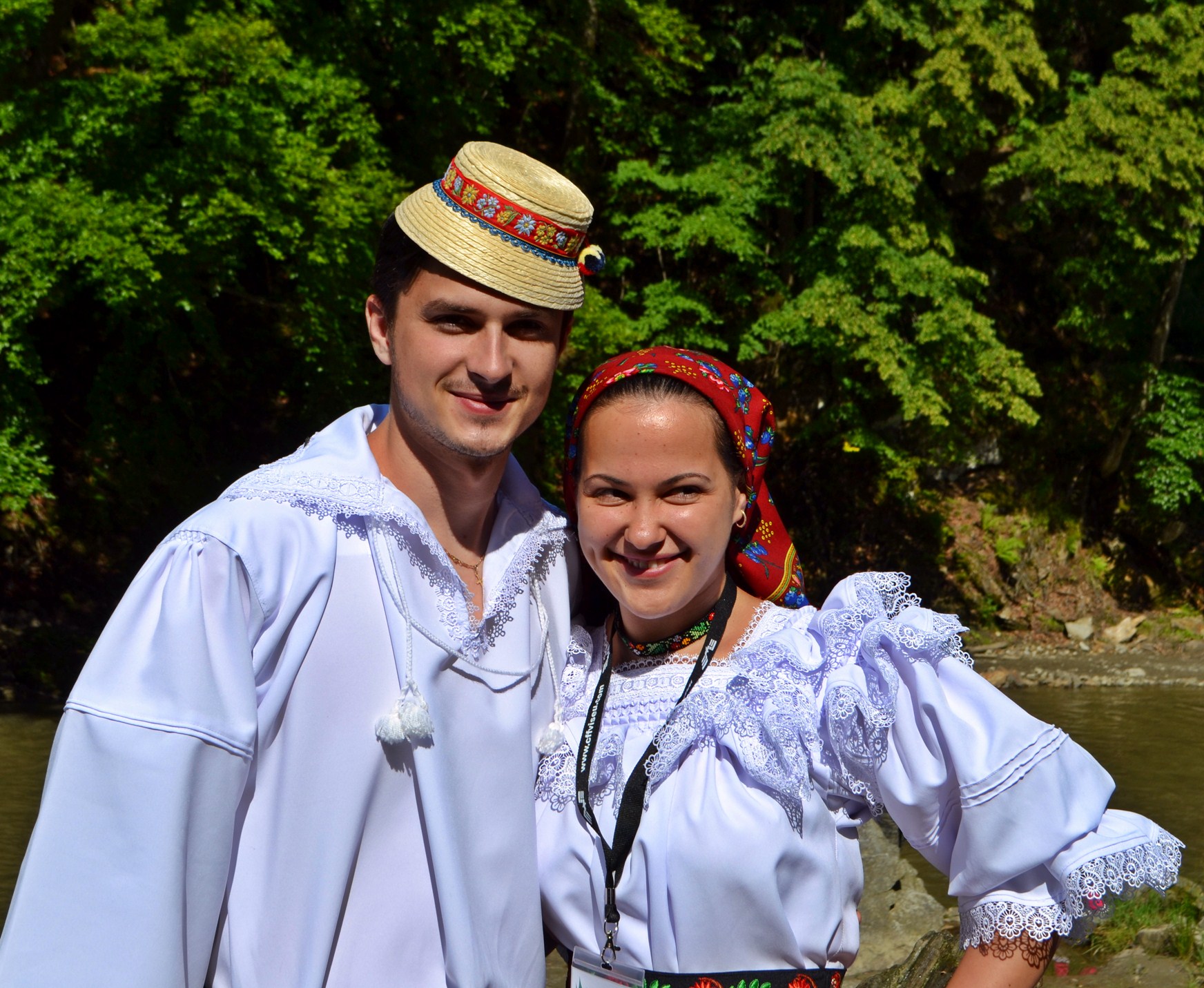
The young people in the image are part of the train’s administrative staff and sell doughnuts (literally) at departure and grilled food at the destination; there are also the so-called ticket collectors (“nașii”) who can be useful for finding out a thing or two about the area.
After about two hours of travel, you reach the Padiș stop, where you can have a meal prepared by the staff transported in the first carriage (prices are reasonable considering the location and conditions)… once you arrive there, queues already form where you pay for the food, and another queue for the food itself; an hour and a half on average, during which you don’t have much time to walk around, but I understood from a “naș” (ticket collector) that there is a viewpoint about half an hour’s climb up the steep slopes in the Padiș area.
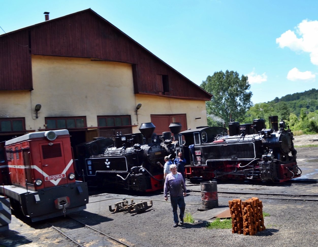
The locomotive rests while the tourists feast
Between 12:30 and one o’clock, the train starts showing signs of impatience and whistles for boarding (in principle, there are about 10 minutes from the moment it starts calling the tourists until it actually sets off… plenty of time for us to gather from the hills)
And look, the Mocănița slowly takes it downhill; the journey seems easier, conversations strike up between passengers and time passes more easily, superb landscapes, bored or rambunctious children… and look, already the Viseu Depot.
A beautiful experience, but I wouldn’t say it’s the best thing that can happen to you in Maramureș (as suggested by the Tripadvisor.com rankings)… if you have small children who don’t appreciate landscapes, it can be a bit frustrating for them, especially toward the end of the trip; if you are an energetic person, it can be just as frustrating to sit in a seat for so many hours without the possibility of exploring the valley on foot.
Unique to me seemed the draisines used by the locals, some of them also for tourist purposes, I suspect.
Other extremely appreciated sights in Maramureș are the old wooden churches of the Iza Valley (Budești, Poienile Izei, Ieud Deal, Desești) and beyond, the Maramureș monasteries (among which Barsana Monastery stands out), and of course, the famous Merry Cemetery of Săpânța.
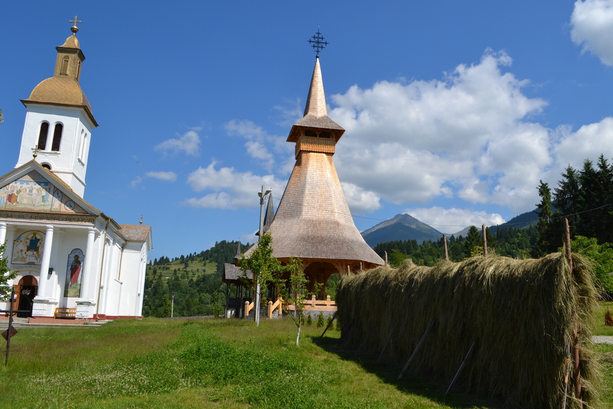
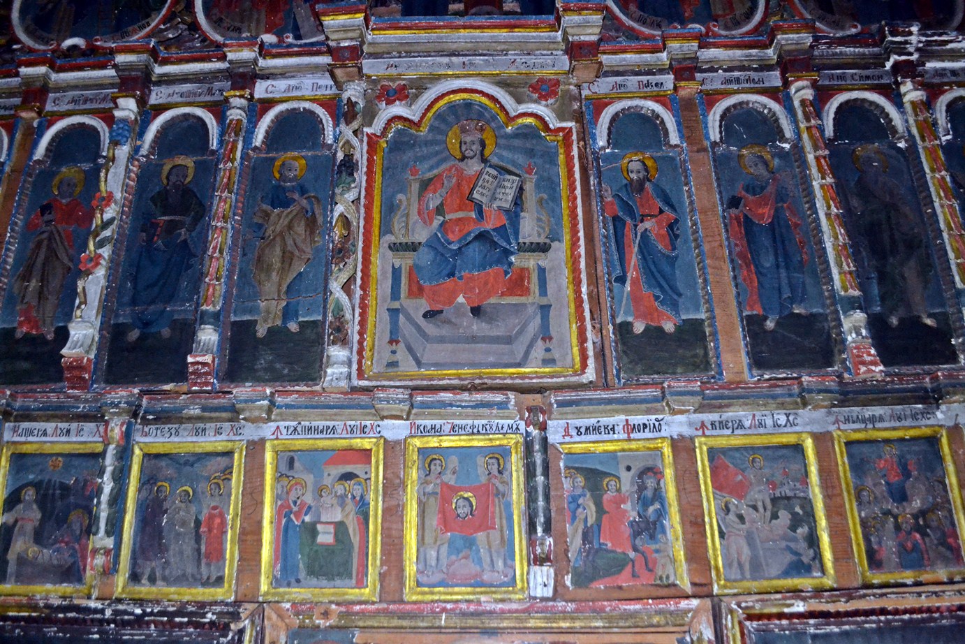
During the time I spent in Maramureș, unfortunately, I visited only one monastery: the Moisei Monastery (it is reached from the road connecting the Șetref Pass to Moisei – via a paved but narrow secondary road); the old church dates from around the beginning of the 17th century and has an interesting history (here)
The old church can be very interesting for believers and non-believers alike, not only due to the age of the paintings inside it, but the exterior of the monastery is also a beautiful area with superb landscapes—perfect for savoring in peace and humility.
For those thirsty for the beauties of nature, Maramureș is a generous destination in all seasons; I focused only on the Borșa area, primarily for Pietrosul Rodnei (at 2,303 meters, it is the highest peak in the Eastern Carpathians), a relatively accessible and spectacular peak.
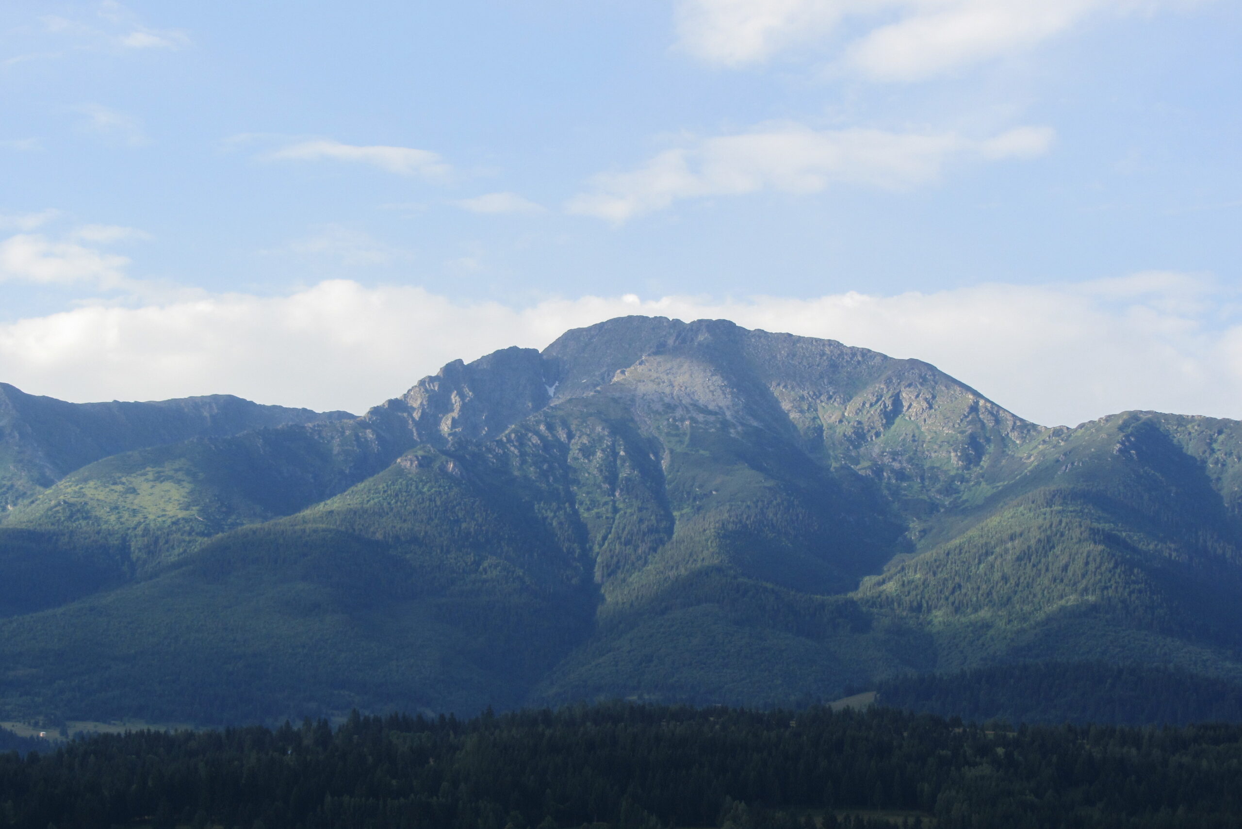
Lofty, seemingly defiant but also proud and generous like a Maramureș native protecting his children (“After a Maramureș cub / Do not throw a boulder / For if you miss him… / Woe to your head it shall be”), PIETROSU Rodnei awaits you to reveal its secrets, found only by those who dare to climb it.
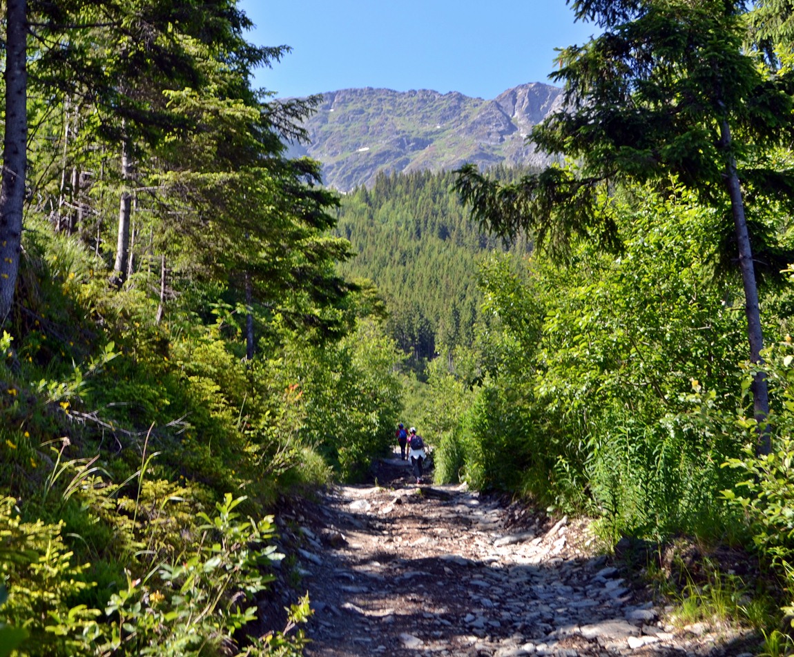
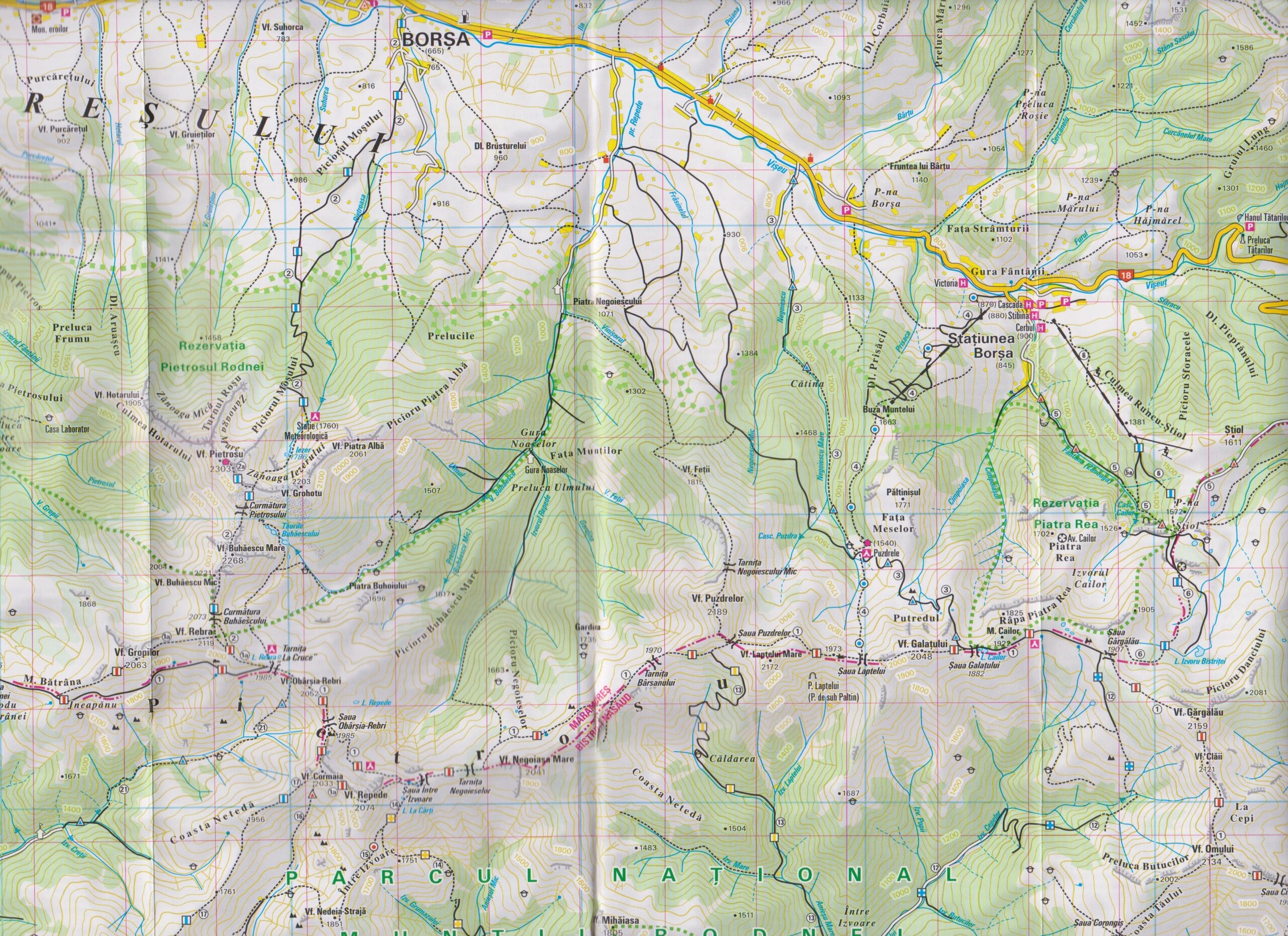
The route we chose is the classic one from Borșa (blue stripe): coming by car from Sighet, you enter Borșa and, after passing the hospital on your right, you take the first right (Avram Iancu Street), then follow the narrow but recently paved road almost to the hermitage where there is a designated parking area (made of logs and gravel) on the bank of a stream; here we left the car and followed the route that overlaps with the forest road which climbs up to the weather station.
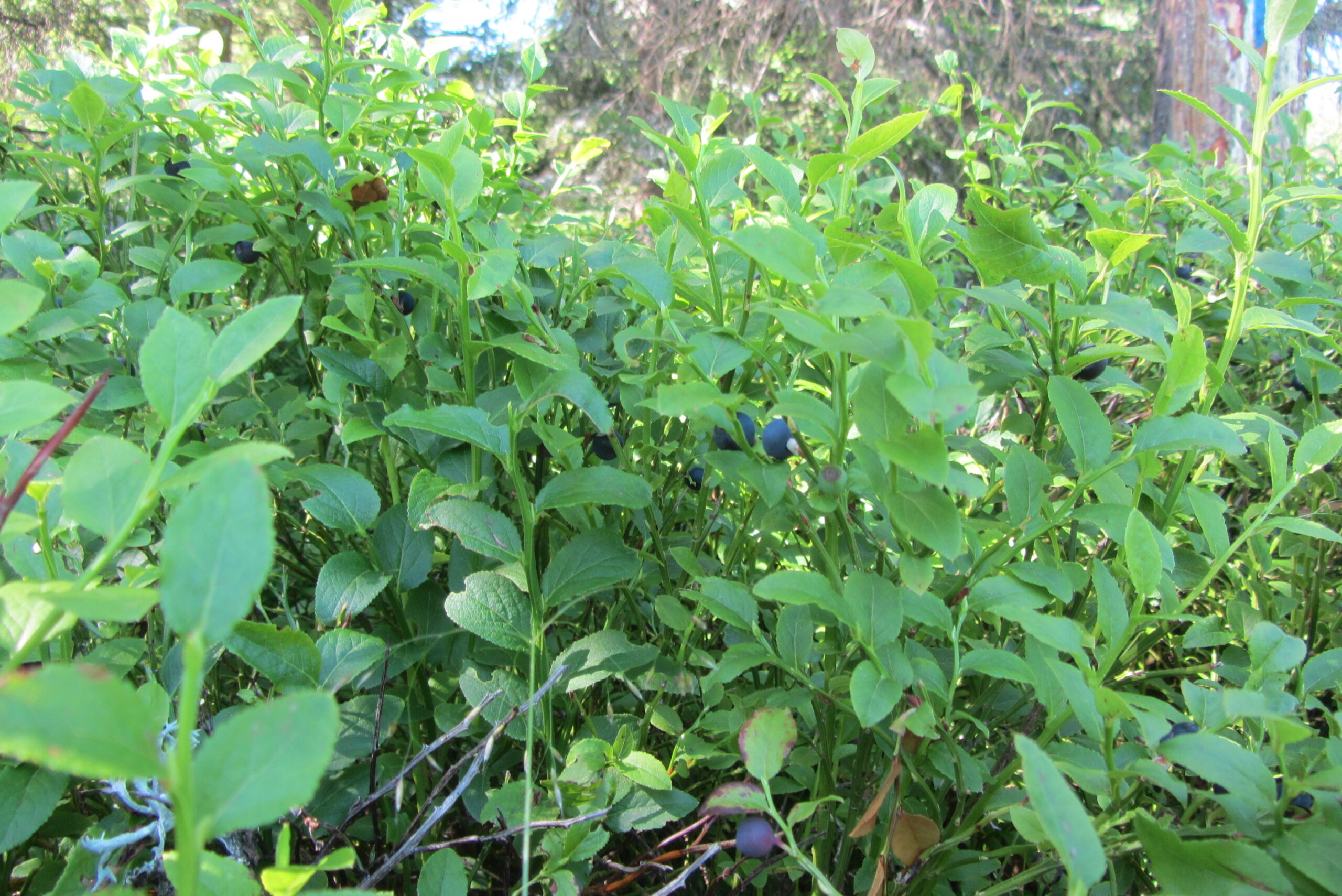
The road is in quite poor condition, and it’s better that way (only off-roaders can drive up it to the Weather Station), and the climb is gentle and full of enchanting views; at lower altitudes, blueberry bushes are omnipresent, and as you climb, the blueberries are increasingly unripe.
After a maximum of two hours of climbing with breaks for hydration and admiring the landscapes, you reach the Weather Station (where, from what I understand, overnight accommodation is still offered to those accustomed to mountain huts).
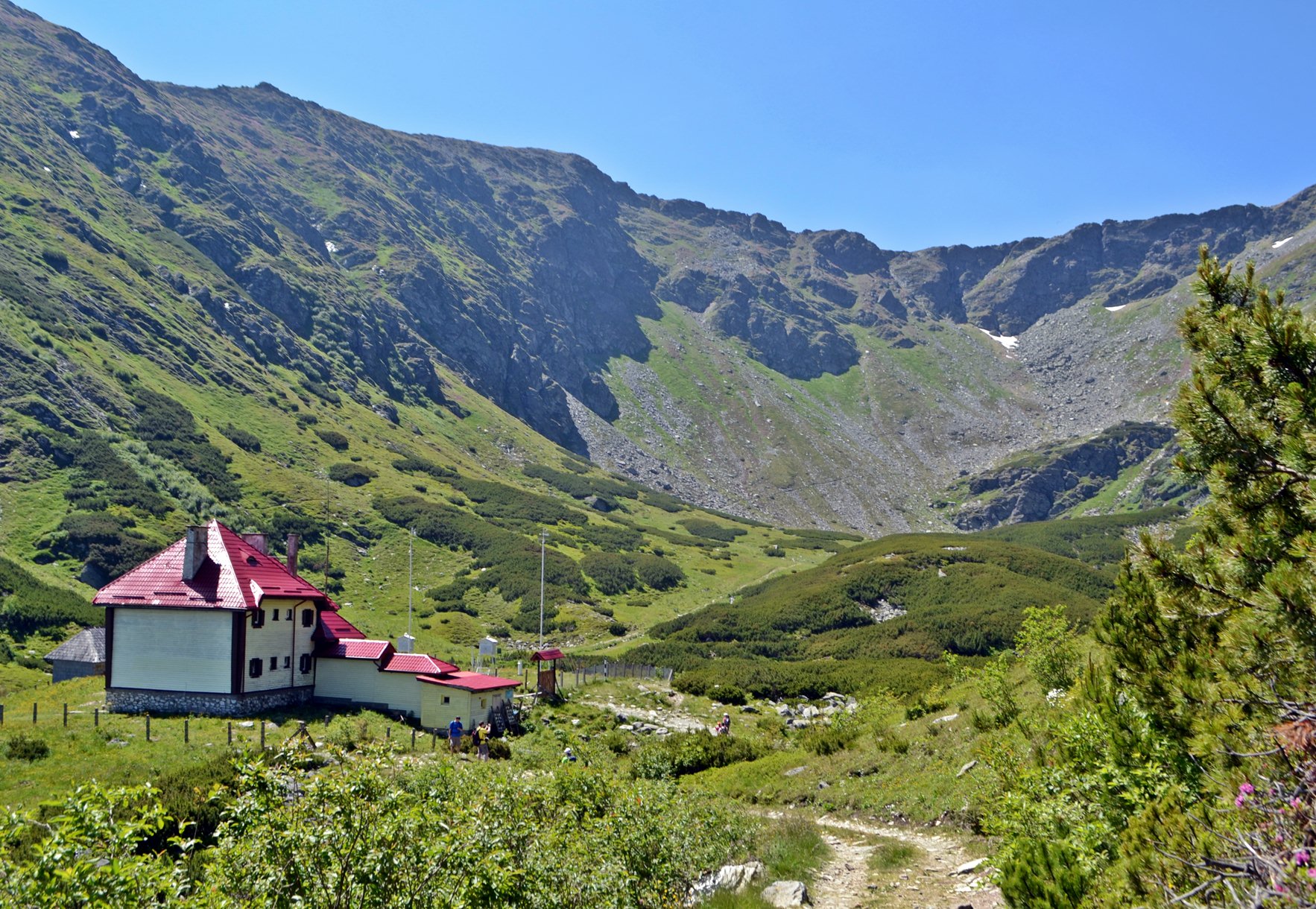
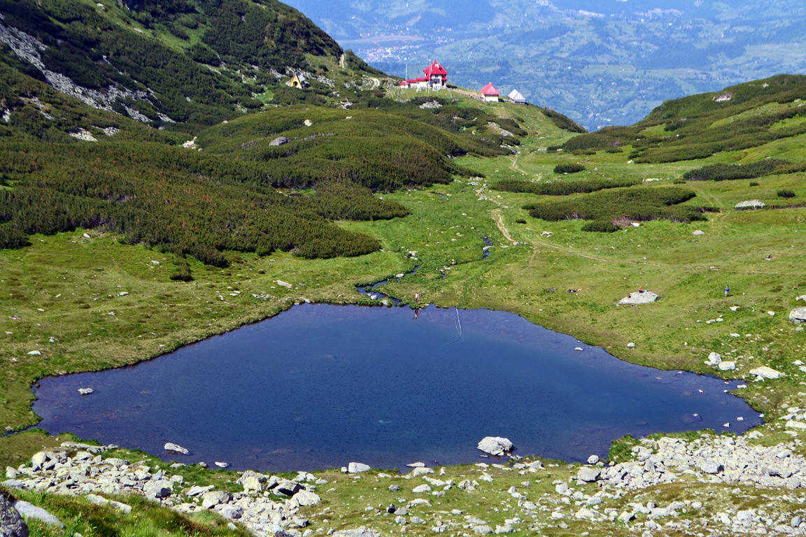
From the Weather Station, in a maximum of fifteen minutes of walking on a superb path through dwarf pines, you reach Lake Iezer (a glacial lake located at the bottom of a glacial cirque) … with clear and cold water; a welcome break, and you begin to search the slopes for the path that leads up to Pietrosu; from here you have between one and two hours left to the top, at an altitude difference of 500 meters; during the climb, the shape of the lake reveals itself, which is extremely familiar to those who have seen the map of Romania 🙂
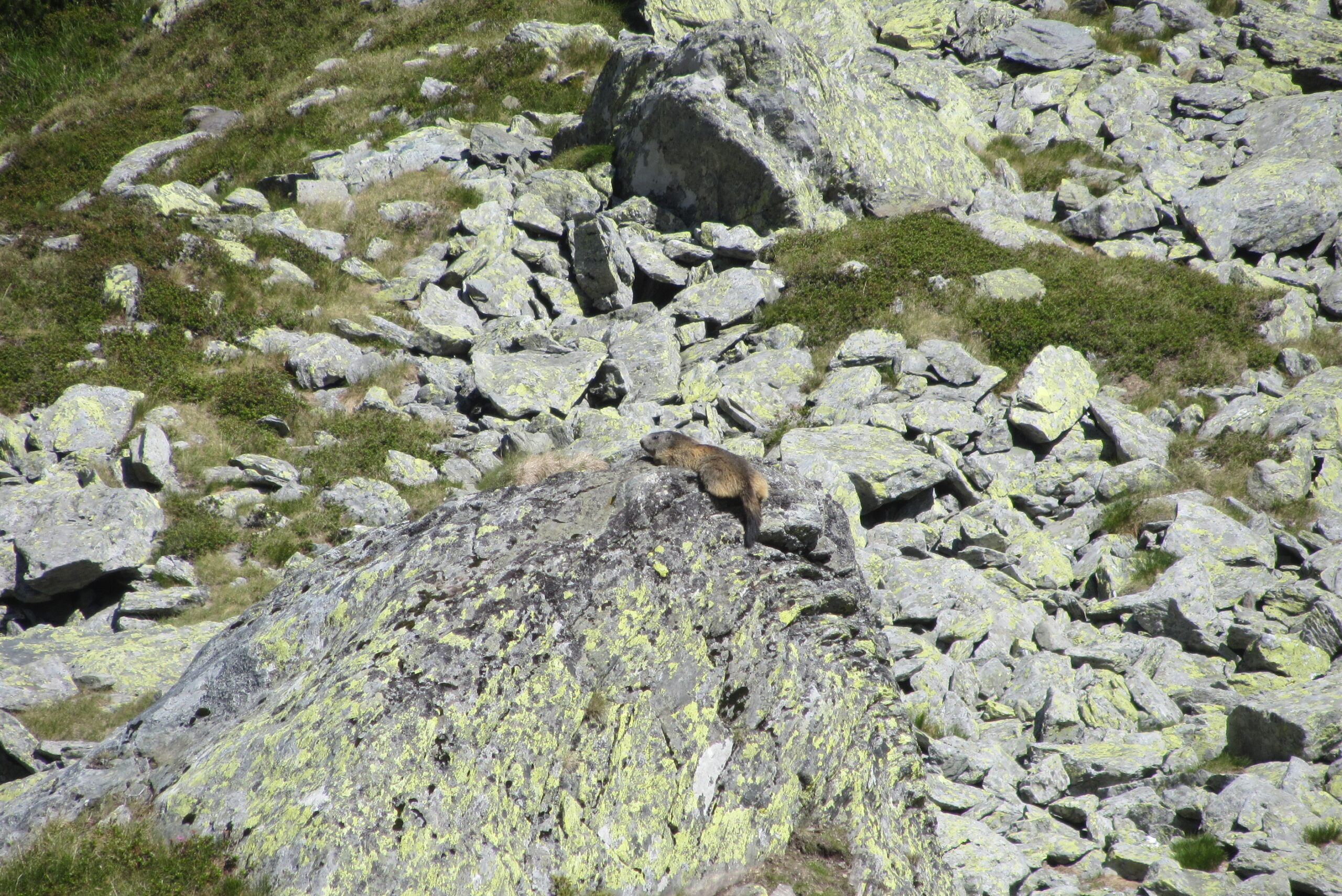
I recommend not rushing because if you have a little patience, you will see marmots near the path (their unmistakable whistles announce the presence of an aerial predator, but most of the time they bask in the sun and play).
Reached the summit, all that’s left for you is to savor the uninterrupted panorama and the peaks you can easily identify: Puzdrelu, Buhăescu Mare, Țibleș, the Maramureș mountains, and so many others, provided you have a map :))
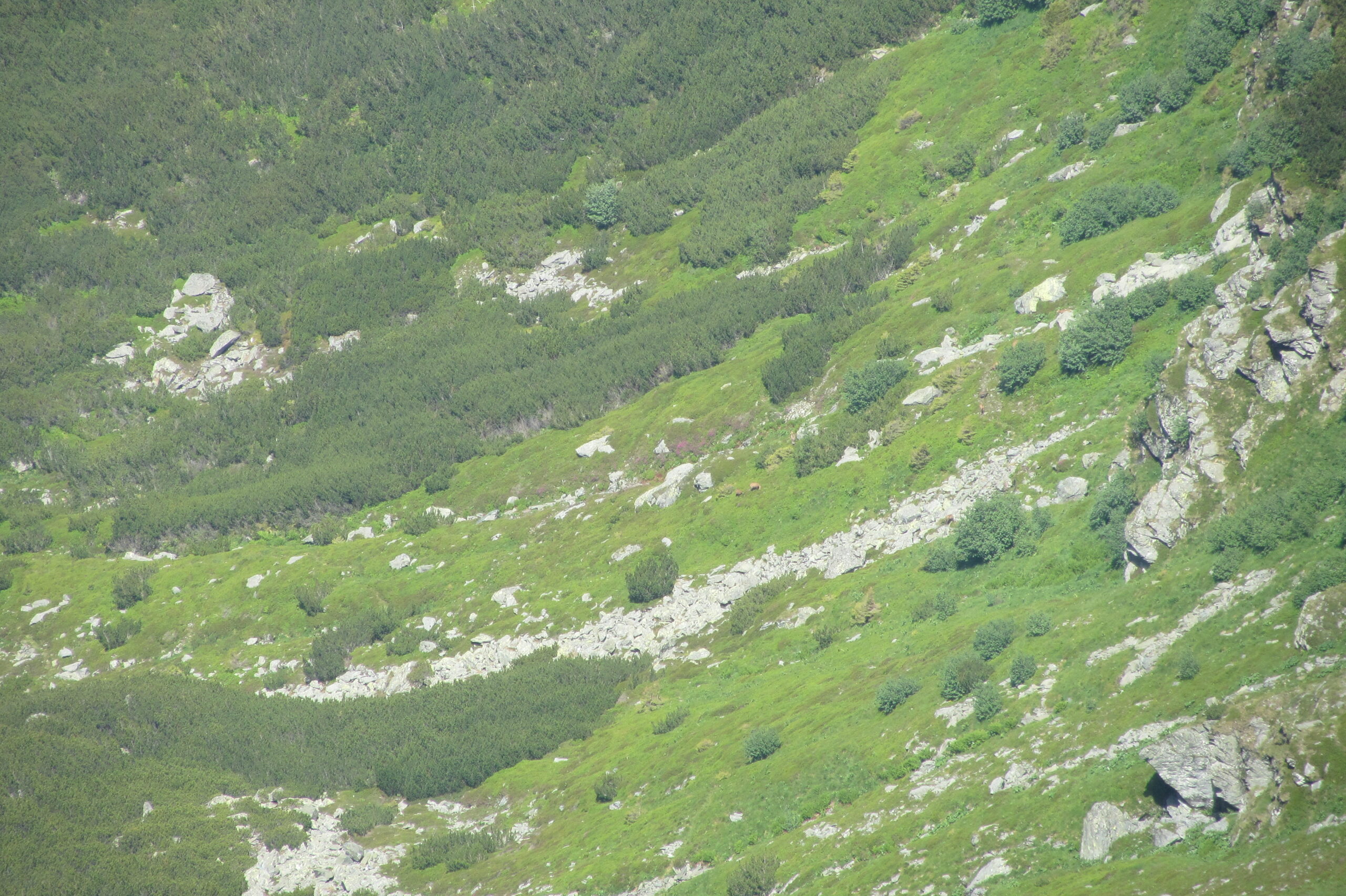
Everything is at a superlative from up there, but it’s even better if you have the luck to come across two rangers with trained eyes who ask for your binoculars (since they were more modestly dressed and sparsely equipped for the mountain, we had a moment of hesitation in giving them our binoculars) so they could see something…
and when they start counting… SURPRISE!!! black goats (chamois)… You’ve truly caught God by the foot; in the high-resolution photo, 8 goats and a kid are visible (hallucinating… how the rangers could see the kid)… for something like this, the term “grateful” was invented; so if someone unknown on the mountain asks for your binoculars, it’s because they want to show you something special and not to run away with them… mountain people are beautiful people (well… except for the poachers and the loggers)
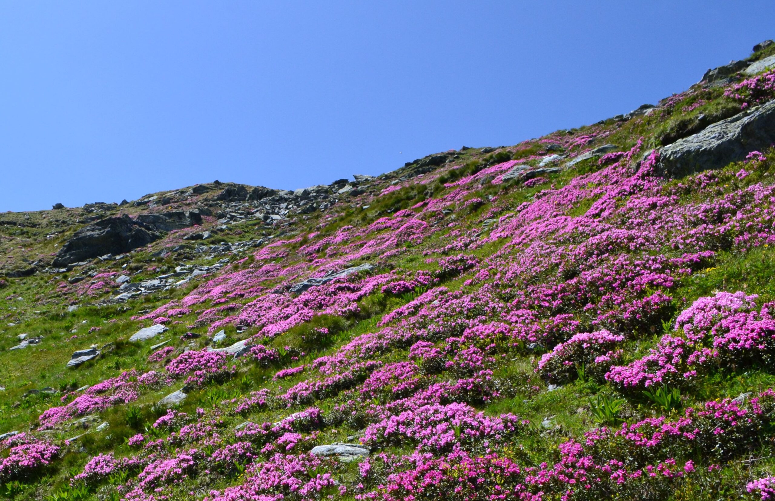
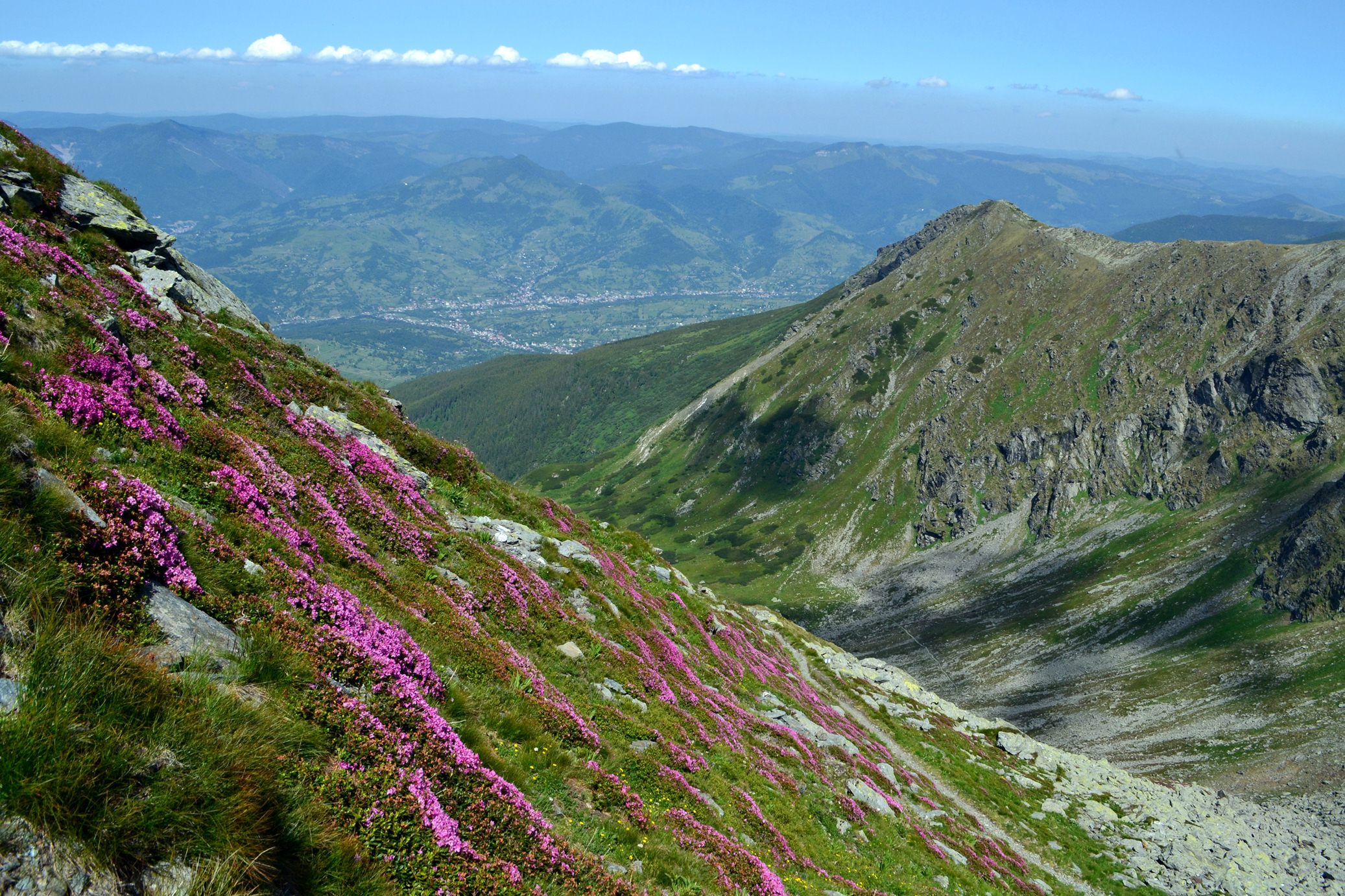
Enthusiastic, you head downhill, spellbound by the beauty of the slopes covered in Mountain Peony flowers (or Smârdar – part of the Rhododendron family) which at this time of year (early July) are mostly shedding their petals but still offer extremely colorful alpine views.
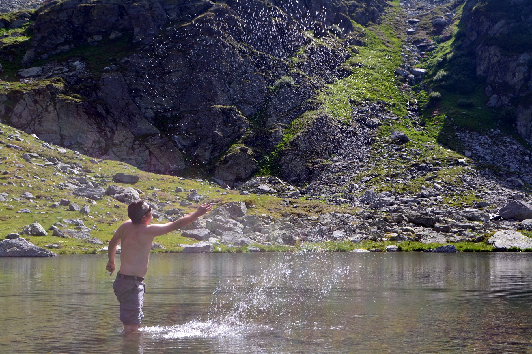
Arrived back at the lake, you can hardly restrain yourself from dipping your feet into it, in a strange sensation of the divine mixed with pain (obviously, a hot foot in water only a few degrees above freezing is an extreme combination).
From here to the car in the valley, we have a maximum of three hours left (including blueberry picking… speaking of blueberries, if you see that you aren’t making much progress picking them, don’t be sad; it means you don’t have a special comb with you, and more patient boys will probably be wandering around your lodging offering full buckets of blueberries at a negotiable price… the one I bargained with for a bucket didn’t have sales skills yet, and I chose to be more generous with him than the market price—somewhere around 35 lei for a 5-liter bucket).
Route conclusions:
– distance traveled: 15 km – medium difficulty
– quite a large elevation gain: starting at 900 meters and reaching 2303 …so about 1400 meters
– the slope is fairly constant
– take water with you as there aren’t many springs, good hiking boots, binoculars, and a raincoat if the weather isn’t 100% favorable (Orange signal is available along almost the entire route)
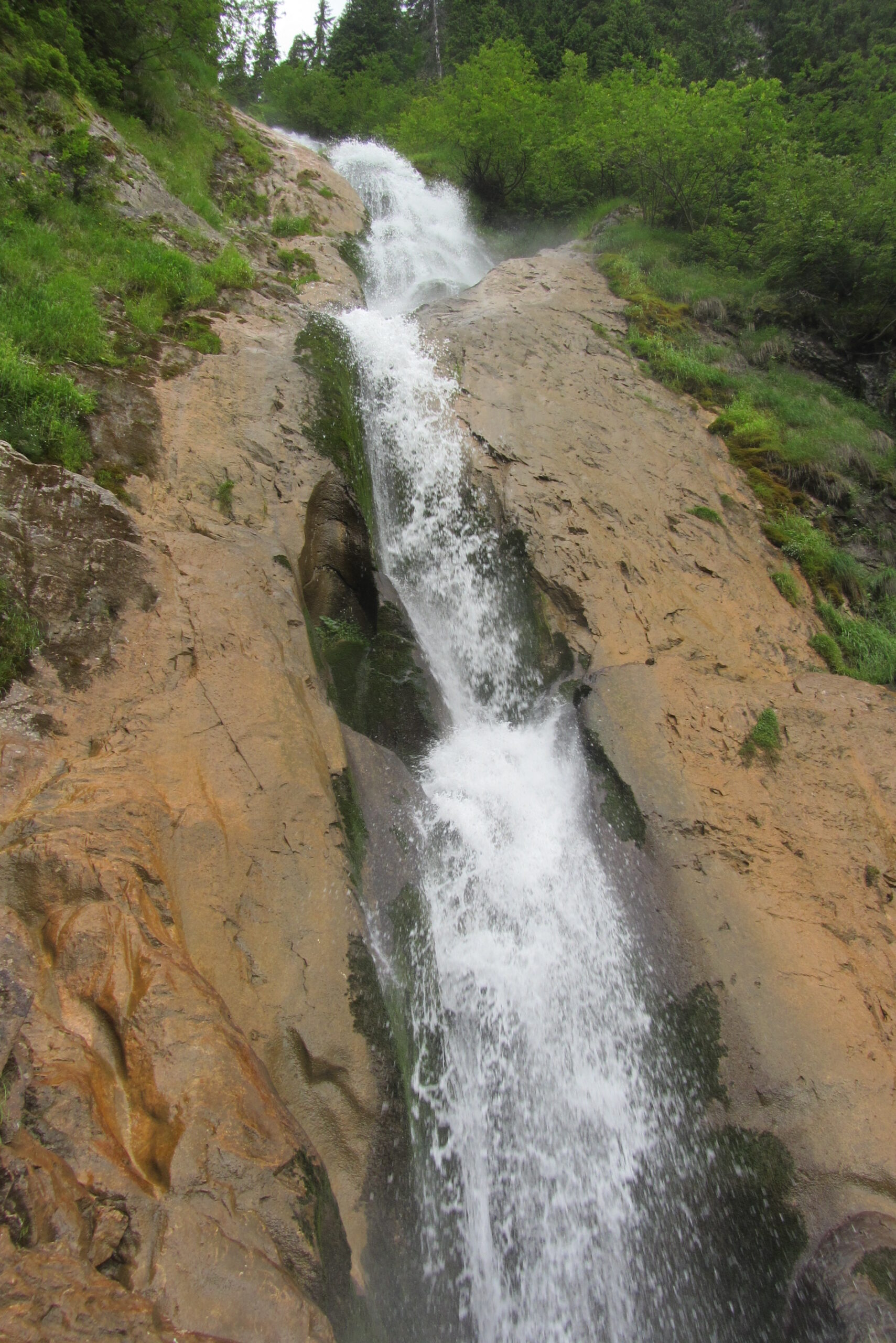
We also wanted to see Horses’ Waterfall (one of the tallest waterfalls in the Carpathians – which has plenty of water this time of year 🙂 ) … you take the chairlift from Borșa resort for about 20 minutes and then hike down toward the waterfall for about another half hour. Obviously, if there’s any chance of rain, it will materialize exactly when you’re on the chairlift or on the trail to the waterfall, so it’s good to have something waterproof and a bit of tolerance for summer rains.
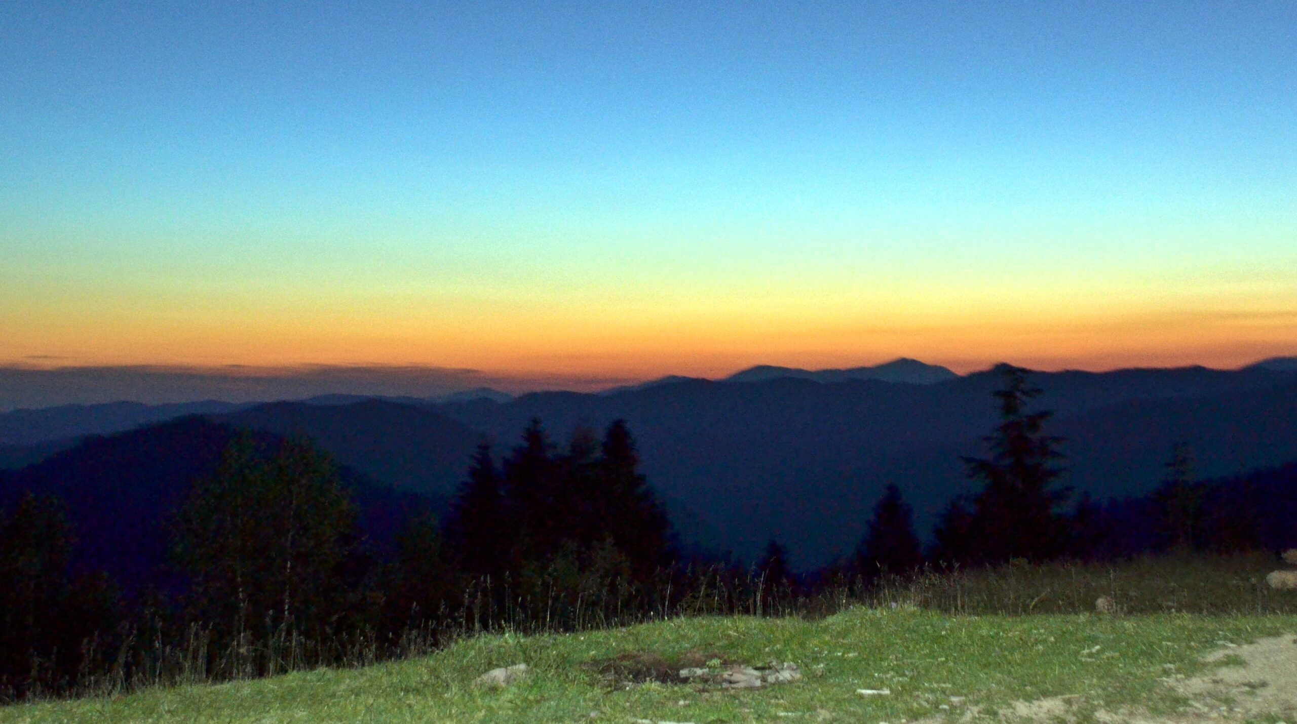
That is about all I managed to do in those two days (three nights) in the Maramureș region … I’m leaving Săpânța, Bârsana, other wooden churches, the Memorial to the Victims of Communism and of the Resistance in Sighet, and other peaks in the area for another time, and I’ll conclude with a suggestive photo taken during an evening off-road trip with a local enthusiast.
Have safe travels in Maramureș and enjoy the hospitality and warmth of the locals just as I did 🙂